Trail Horseback riding Neussargues en Pinatelle - chalinargue 2 - Photo
© OpenStreetMap contributors
Length
Length
26 km
Max alt
Max alt
1238 m
Uphill gradient
Uphill gradient
604 m
Km-Effort
Km-Effort  
34 km
Min alt
Min alt
1021 m
Downhill gradient
Downhill gradient
606 m
Boucle
Boucle
Yes
Creation date :
2019-07-29 08:20:17.649
Updated on :
2019-07-29 15:51:06.793

(1 Reviews)

Horseback riding
Horseback riding
5h14
Difficulty : Easy

Scan this QR Code to open this trail in the SityTrail application

FREE GPS app for hiking

Logo SityTrail SityTrail

IGN / Geographical institutes

Download SityTrail from the App Store Download SityTrail from Google Play

Logo SityTrail SityTrail World

The world is yours!

Download SityTrail from the App Store Download SityTrail from Google Play Download SityTrail on Huawei AppGallery

About

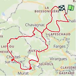
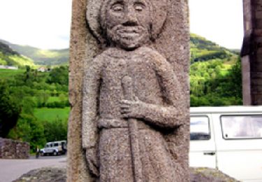
Trail Horseback riding of 26 km to be discovered at Auvergne-Rhône-Alpes, Cantal, Neussargues en Pinatelle. This trail is proposed by btrotignon.

Description

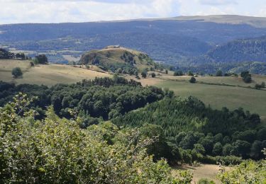
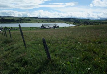
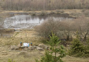
beaux paysages mais beaucoup de cailloux !

Elevation profile

Positioning

Country:
France
Region :
Auvergne-Rhône-Alpes
Department/Province :
Cantal
Municipality :
Neussargues en Pinatelle
Location:
Chalinargues
Start:(UTM)
493626 ; 5000872 (31T) N.

Comments

Please log in to post a review or rate the element


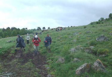
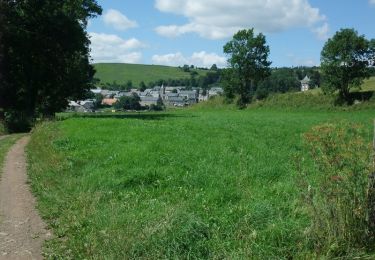
Très belle randonnée avec des points de vue magnifiques. Pas mal de possibilités de faire des allures


Trails nearby

Trail Walking Murat - les estives et tourbière de Chastel sur Murat - Photo
Walking
phil33

Walking

Easy
(1)
Murat, Auvergne-Rhône-Alpes, Cantal, France
7.7 km | 10.5 km-effort
2h 16min
Yes
Trail Walking Neussargues en Pinatelle - Sentier des vieilles pierres - Photo
Walking
tracegps

Walking

Difficult
(1)
Neussargues en Pinatelle, Auvergne-Rhône-Alpes, Cantal, France
13.9 km | 18.4 km-effort
4h 0min
No
Trail Walking Neussargues en Pinatelle - Cantal 2015 Les vieilles pierres - Photo
Walking
neleda

Walking

Easy
Neussargues en Pinatelle, Auvergne-Rhône-Alpes, Cantal, France
15.7 km | 21 km-effort
4h 27min
Yes
Trail Walking Neussargues en Pinatelle - La Via Arverna (Neussargues - Murat)  - Photo
Walking
tracegps

Walking

Difficult
Neussargues en Pinatelle, Auvergne-Rhône-Alpes, Cantal, France
24 km | 31 km-effort
6h 45min
No
Trail Walking Dienne - La pinatelle de Parre - Fortuniès - Photo
Walking
tracegps

Walking

Medium
(1)
Dienne, Auvergne-Rhône-Alpes, Cantal, France
12.6 km | 16 km-effort
3h 30min
Yes
Trail Walking Dienne - De Fortuniès à Chastel sur Murat via le Lac du Pêcher - Photo
Walking
tracegps

Walking

Difficult
Dienne, Auvergne-Rhône-Alpes, Cantal, France
26 km | 33 km-effort
7h 0min
No
Trail Walking Dienne - Rando en boucle sur le plateau de la Pinatelle - Photo
Walking
ilur56

Walking

Easy
Dienne, Auvergne-Rhône-Alpes, Cantal, France
14.8 km | 19 km-effort
3h 7min
Yes
Trail Walking Murat - Tourbières de Chastel sur Murat - Photo
Walking
ilur56

Walking

Easy
Murat, Auvergne-Rhône-Alpes, Cantal, France
9.2 km | 12.7 km-effort
2h 27min
Yes
Trail Walking Neussargues en Pinatelle - Chavagnac - Photo
Walking
tracegps

Walking

Medium
Neussargues en Pinatelle, Auvergne-Rhône-Alpes, Cantal, France
9.5 km | 12.4 km-effort
3h 0min
Yes


Close
My subscriptions